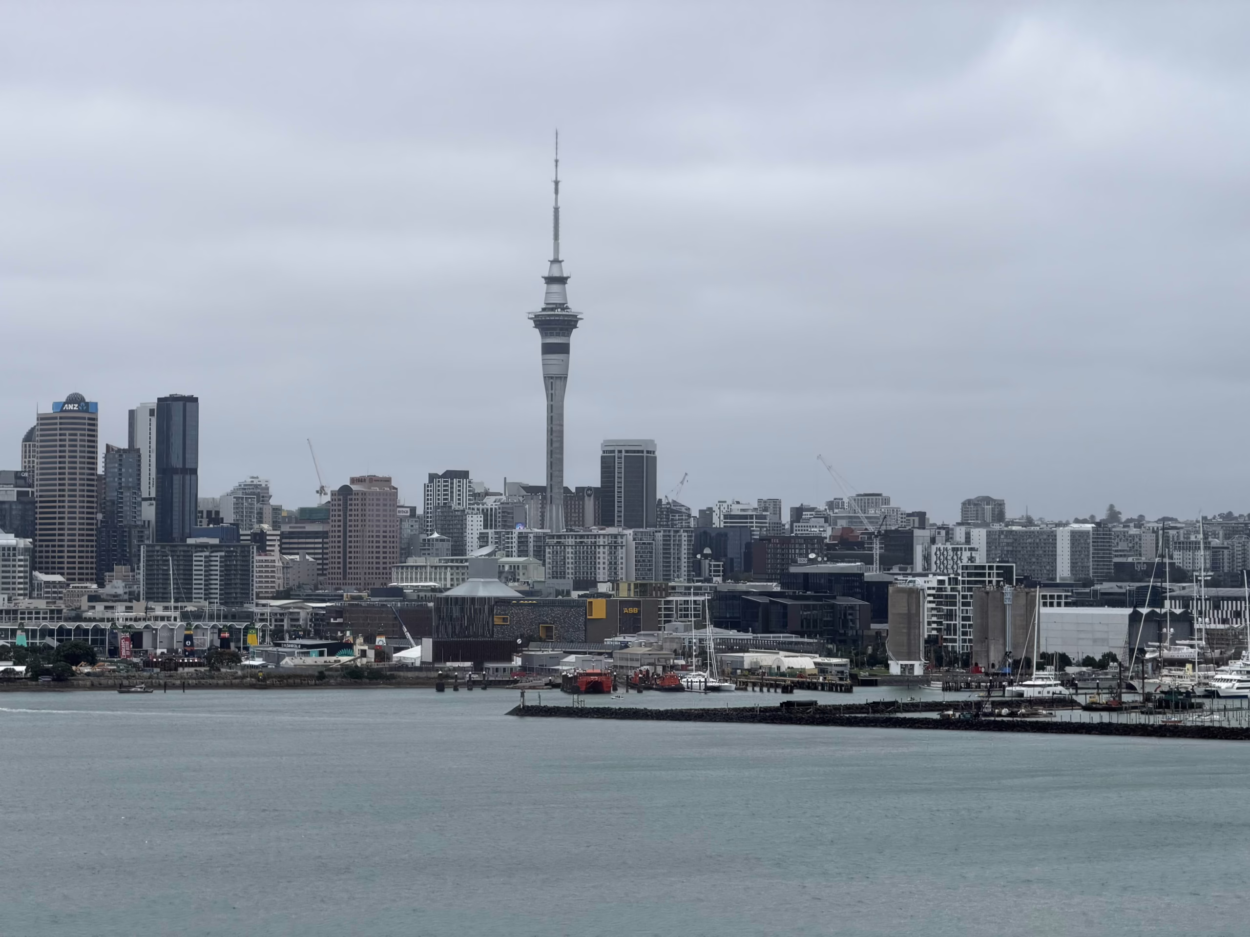
Auckland is blessed with some of New Zealand's most diverse and stunning landscapes—all within easy driving distance of the city. From the rugged black-sand beaches of the wild west coast to the pohutukawa-lined shores of the east, there's a scenic drive waiting for every mood and occasion.
Whether you're a tourist exploring New Zealand for the first time or a local looking for a weekend escape, this guide covers the best scenic drives around Auckland with accurate driving times, key stops, photo opportunities, and practical tips to help you make the most of your journey.
Quick Navigation:
- West Auckland Drives (Waitakere Ranges)
- North Shore & Hibiscus Coast Drives
- East Auckland & Pohutukawa Coast Drives
- South Auckland Drives
- Extended Day Trip Drives
West Auckland Drives (Waitakere Ranges)
1. Scenic Drive to Piha Beach
The Route: Auckland CBD → Titirangi → Scenic Drive → Piha Road → Piha Beach
Distance: 40 km (24 miles)
Driving Time: 45–55 minutes (without stops)
Best Season: Year-round (summer for swimming, winter for dramatic surf)
This is Auckland's quintessential scenic drive, and there's a good reason the road is literally named "Scenic Drive." Starting from Titirangi—a charming village known for its art galleries and cafés—the route winds through the bush-clad Waitākere Ranges, offering sweeping views over native rainforest and the Manukau Harbour.
Key Stops:
- Titirangi Village: Browse art galleries, grab a coffee at one of the pavement cafés, and admire Lopdell House before heading into the ranges.
- Arataki Visitor Centre: Located about 6 km past Titirangi on Scenic Drive. Don't miss the 11-metre carved kauri pou (post) at the entrance depicting Māori ancestors. The viewing platforms offer panoramic views of the Manukau Harbour and Auckland skyline. Free admission. Open 9am–5pm daily.
- Piha Beach: One of New Zealand's most iconic surf beaches, featuring the dramatic Lion Rock landmark rising from the black iron sand.
Photo Spots:
- Arataki Visitor Centre lookout (harbour views)
- Lion Rock at Piha (best at sunset)
- North Piha lookout walk
Fuel Stop: Fill up in Titirangi or central Auckland—there are no petrol stations in the Waitakere Ranges or at Piha.
Driving Tips: The roads are narrow and winding with blind corners. Take your time, stay left, and use passing bays. Watch for cyclists on weekends.
Recommended Vehicle: Any vehicle is suitable, though SUVs offer more comfort on winding roads. Browse our vehicle range.
2. Muriwai Beach & Gannet Colony
The Route: Auckland CBD → Northwestern Motorway (SH16) → Kumeu → Waimauku → Muriwai Road → Muriwai Beach
Distance: 42 km (26 miles)
Driving Time: 45–50 minutes
Best Season: August to March for gannet viewing (peak: October–February)
This drive takes you through Auckland's wine country before arriving at one of New Zealand's most accessible mainland gannet colonies. The journey through rolling farmland and the green Waimauku countryside creates a pleasant contrast to the wild, windswept beach at journey's end.
Key Stops:
- Kumeu & Huapai: Auckland's wine region with several cellar doors. Soljans Estate and Coopers Creek are popular options.
- Muriwai Gannet Colony: About 1,200 pairs of Australasian gannets nest at Ōtakamiro Point from August to March. Viewing platforms put you metres away from these magnificent seabirds. Free access.
- Muriwai Beach: A dramatic 60 km stretch of black iron sand stretching north to the Kaipara Harbour. Popular with surfers (experienced only—the beach has dangerous rips).
- Maukatia/Māori Bay: South of the main beach, featuring ancient pillow lava formations in the cliffs and excellent surfing.
Photo Spots:
- Gannet colony viewing platforms
- Muriwai Beach from the clifftop lookouts
- Pillow lava at Māori Bay
Fuel Stop: Kumeu or Waimauku—no fuel at Muriwai.
Wildlife Note: Gannets arrive in August, lay eggs from September, and chicks are visible from November. By March, most have departed. The young birds make a one-way flight to Australia and don't return for several years.
3. Karekare Beach via Lone Kauri Road
The Route: Auckland CBD → Titirangi → Scenic Drive → Piha Road → Lone Kauri Road → Karekare
Distance: 45 km (28 miles)
Driving Time: 55–65 minutes
Best Season: Year-round
For those seeking solitude, Karekare is Auckland's most isolated and pristine west coast beach—famously featured in the film "The Piano." The drive down Lone Kauri Road is an adventure in itself, winding steeply through dense native bush.
Key Stops:
- Karekare Beach: A completely natural beach with no commercial development. Pure wilderness.
- Karekare Falls: Visible from the road near the beach entrance. A short walk leads to the base.
- Sand Dunes: Great for sandboarding if you bring cardboard!
Driving Tips: Lone Kauri Road is very narrow and winding—stay well to the left and expect vehicles coming the other way. Not recommended for nervous drivers or large vehicles.
North Shore & Hibiscus Coast Drives
4. Hibiscus Coast Highway (Silverdale to Wenderholm)
The Route: Auckland CBD → Northern Motorway → Silverdale → Orewa → Waiwera → Wenderholm Regional Park
Distance: 50 km (31 miles)
Driving Time: 45–55 minutes
Best Season: Year-round (summer for swimming)
The Hibiscus Coast Highway is one of Auckland's most popular scenic routes, running past golden sandy beaches and through communities that retain a relaxed coastal village atmosphere. The region gets its name from the hibiscus trees planted along the coast in the 1960s.
Key Stops:
- Orewa Beach: Auckland's longest and most popular northern beach, with safe swimming and a bustling town centre with cafés and shops.
- Red Beach: Named for its distinctive reddish-toned cliffs—great beginner surf beach.
- Hatfields Beach: Quieter alternative with pohutukawa-lined shores.
- Wenderholm Regional Park: Auckland's first regional park (established 1965), featuring native bush walks, safe swimming beach, and the historic Couldrey House. Perfect for picnics with BBQ facilities.
Photo Spots:
- Orewa pier stretching into the sea
- Red Beach cliff formations
- Wenderholm lookouts over the Pūhoi River estuary
Extend Your Trip: Continue north to Pūhoi village—one of New Zealand's oldest Bohemian settlements with a famous historic pub serving traditional Czech-style beer.
5. Matakana Coast & Leigh
The Route: Auckland CBD → Northern Motorway → Warkworth → Matakana → Leigh
Distance: 80 km (50 miles)
Driving Time: 1 hour to Matakana, 1 hour 10 minutes to Leigh
Best Season: Year-round (weekends for Matakana Farmers' Market)
This is one of Auckland's most rewarding day-trip routes, combining wine country charm with coastal beauty. The drive north through the Johnstone's Hill Tunnel brings you to a world that feels far removed from the city.
Key Stops:
- Matakana Village: A boutique wine and food destination with artisan producers, galleries, and the famous Matakana Cinemas (cinema-and-dinner experience). The Saturday Farmers' Market (8am–1pm) is one of Auckland's best.
- Matakana Wine Region: Multiple vineyards and cellar doors offering tastings—Ascension, Brick Bay, and Ransom are popular choices.
- Leigh: A small fishing village with the historic Leigh Sawmill Café (now called The Stables) and access to Goat Island Marine Reserve—New Zealand's first marine reserve, established in 1975.
- Goat Island: Snorkelling paradise with crystal-clear water teeming with fish that have no fear of humans.
Photo Spots:
- Brick Bay Sculpture Trail
- Leigh Harbour and fishing boats
- Underwater photos at Goat Island (bring a waterproof camera!)
Fuel Stop: Warkworth has full services including supermarkets. Limited fuel options beyond Matakana.
6. Whangaparāoa Peninsula to Shakespear Regional Park
The Route: Auckland CBD → Northern Motorway → Silverdale → Whangaparāoa Road → Army Bay → Shakespear Regional Park
Distance: 50 km (31 miles)
Driving Time: 50–60 minutes
Best Season: Year-round
The Whangaparāoa Peninsula stretches 25 km into the Hauraki Gulf, culminating in Shakespear Regional Park—a predator-free sanctuary with incredible views and wildlife.
Key Stops:
- Gulf Harbour Marina: Upmarket marina village with restaurants and ferry connections to downtown Auckland.
- Army Bay: Popular diving and boat launch area with views to Tiritiri Matangi Island.
- Shakespear Regional Park: A pest-free sanctuary at the peninsula's tip with walking tracks through regenerating native bush, WWII gun emplacements, and swimming beaches. Free entry.
Photo Spots:
- Shakespear Park "Giant Frame" photo spot
- 360-degree views from Te Haruhi Bay
- Views back to Auckland city from the peninsula
East Auckland & Pohutukawa Coast Drives
7. The Pohutukawa Coast (Whitford to Clevedon)
The Route: Auckland CBD → Howick → Whitford → Beachlands → Maraetai → Umupuia → Clevedon
Distance: 50 km (31 miles) loop
Driving Time: 1 hour 15 minutes (coastal route without stops)
Best Season: December–January for pohutukawa flowers; year-round for scenery
This is often called the most beautiful coastline in Auckland. The Pohutukawa Coast gets its name from the gnarly native trees that line the shores, bursting into brilliant crimson blooms around Christmas time. The narrow coastal road hugging the cliffs from Maraetai to Umupuia is regularly featured in New Zealand tourism promotions.
Key Stops:
- Whitford Village: A charming rural service centre with the Stables Pub and artisan food shops. Great starting point.
- Ōmana Regional Park: Clifftop campground with stunning Hauraki Gulf views. The 10-minute clifftop walk or the 1.5-hour Beachlands-Maraetai Walkway are both excellent.
- Maraetai Beach: A beautiful 1 km golden sand beach with a wharf (popular for jumping at high tide), cafés, and safe swimming. Vies with Eastern Beach for the title of "best beach in East Auckland."
- Magazine Bay: One of the most photographed stretches of road in New Zealand—the narrow pohutukawa-lined road hugging the cliff edge above the sea.
- Duder Regional Park: Historic farmland on the Whakakaiwhara Peninsula with walking tracks and views. The Tainui waka (canoe) landed here in the 14th century.
- Clevedon: A rural village with craft galleries, cafés, and the excellent Hallertau Brewery. Don't miss the Clevedon Village Farmers Market (Sunday mornings).
Photo Spots:
- Magazine Bay road (arrive early to avoid traffic)
- Maraetai wharf at sunset
- Pohutukawa trees in bloom (December)
- Duder Regional Park peninsula lookout
Driving Tips: The coastal road from Maraetai to Umupuia is narrow with tight corners—drive slowly and watch for oncoming traffic.
Cultural Note: The Pohutukawa Coast holds deep significance to Ngāi Tai ki Tāmaki, the local iwi whose marae is at Umupuia. The area has been continuously occupied since the earliest days of Māori settlement in Aotearoa.
8. Hunua Ranges & Hunua Falls
The Route: Auckland CBD → Southern Motorway → Papakura → Hunua Road → Hunua Falls
Distance: 50 km (31 miles)
Driving Time: 50–60 minutes
Best Season: Year-round (waterfalls most impressive after rain)
The drive through the Hunua Gorge is one of Auckland's hidden gems—a winding road through native bush that feels far removed from the city. The Hunua Ranges are Auckland's largest forested landscape and the source of much of the city's water supply.
Key Stops:
- Hunua Gorge: The scenic drive through the gorge features several pull-off spots with hidden waterfalls visible from the road.
- Hunua Falls: A spectacular 30-metre waterfall plunging into a pool below. The walk from the car park takes just 15 minutes on an easy, well-maintained track. A "photo frame" installation helps capture the perfect shot.
- Wairoa Reservoir: Scenic dam with walking tracks and picnic areas.
Photo Spots:
- Hunua Falls from the viewing platform
- Giant photo frame at the falls
- Hidden waterfalls along Hunua Road
Wildlife: The Hunua Ranges are home to Auckland's only mainland population of the rare North Island kōkako bird and provide a refuge for the native Hochstetter's frog.
Important: Clean your footwear at the cleaning stations before entering walking tracks to help prevent kauri dieback disease.
South Auckland Drives
9. Āwhitu Peninsula & Manukau Heads Lighthouse
The Route: Auckland CBD → Southern Motorway → Pukekohe → Waiuku → Āwhitu Peninsula → Manukau Heads Lighthouse
Distance: 85 km (53 miles)
Driving Time: 1 hour 45 minutes to lighthouse
Best Season: Year-round (clear days for views)
This is one of Auckland's most dramatic and least-known scenic drives. The Āwhitu Peninsula forms the southern side of the Manukau Harbour entrance, and the drive to the Manukau Heads Lighthouse offers stunning coastal views and a sense of real remoteness.
Key Stops:
- Waiuku: A charming rural town with heritage buildings, cafés, and the gateway to the peninsula.
- Āwhitu Regional Park: Coastal bush walks and panoramic harbour views.
- Manukau Heads Lighthouse: One of New Zealand's few lighthouses open to the public. The views from the top are breathtaking—looking out over the treacherous Manukau Bar where the HMS Orpheus sank in 1863 (New Zealand's worst shipwreck disaster, with 189 lives lost). On a clear day, you can see Auckland's Sky Tower and even Mt Taranaki to the southwest.
- Karioitahi Beach: Dramatic black sand surf beach accessible by vehicle (4WD recommended).
Photo Spots:
- Lighthouse and Manukau Bar panorama
- Māori carvings on the walk to the lighthouse
- Rolling hills of the Āwhitu Peninsula
Lighthouse Hours: 9am–5pm daily. Free entry (donations welcome).
Fuel Stop: Waiuku—no fuel north of Waiuku on the peninsula.
Extended Day Trip Drives
10. Coromandel Peninsula Loop (From Auckland)
The Route: Auckland → SH1 → SH2 → Thames → SH25 (Coromandel coastal road) → Coromandel Town → (optional: 309 Road) → Whitianga → Hot Water Beach → Cathedral Cove → Tairua → return via SH25A and SH2
Distance: 400+ km full loop
Driving Time: 6–8 hours driving (full day or overnight recommended)
Best Season: Summer (December–February) for swimming
The Coromandel Peninsula is one of New Zealand's most spectacular coastal drives and is easily accessible as a day trip or overnight from Auckland. The winding coastal road (SH25) isn't for the faint-hearted—blind curves and narrow edges require careful driving—but the views are absolutely worth it.
Key Stops:
- Thames: Historic gold-mining town with interesting heritage buildings.
- Coromandel Town: Artsy township with galleries, crafts, and the famous Driving Creek Railway.
- Cathedral Cove: An iconic natural archway leading to a pristine beach—one of New Zealand's most photographed locations. Note: 45-minute walk each way from the car park.
- Hot Water Beach: Dig your own hot pool in the sand (tidal—works 2 hours either side of low tide).
Driving Tips: The coastal road has many blind corners. Take your time, stay left, and use passing bays. Consider doing the loop over two days with an overnight stay.
Recommended Vehicle: SUV or comfortable sedan. The roads are sealed but winding. View our SUV range.
11. Northland via SH16 (Kaipara Coast Alternative)
The Route: Auckland → Northwestern Motorway (SH16) → Kumeu → Helensville → Kaipara Coast → Wellsford → SH1 North
Distance: To Wellsford: 85 km (53 miles)
Driving Time: 1 hour 15 minutes to Wellsford
Best Season: Year-round
If you're heading north and want to avoid the busy State Highway 1, the Kaipara Coast route via SH16 offers a more scenic and relaxed alternative. The road winds through rural farmland with views of the Kaipara Harbour—New Zealand's largest harbour.
Key Stops:
- Kumeu Wine Region: Multiple cellar doors within minutes of each other.
- Helensville: Rural service town with historic railway station and the Parakai Hot Springs nearby.
- Kaipara Harbour Views: The harbour is enormous—covering 947 square kilometres—and the road offers multiple viewing opportunities.
12. Long Bay to Tawharanui (Ultimate North Shore Drive)
The Route: Auckland CBD → Long Bay Regional Park → Orewa → Warkworth → Tawharanui Regional Park
Distance: 90 km (56 miles)
Driving Time: 1 hour 30 minutes
Best Season: Year-round
This drive combines Auckland's best northern beaches with a genuine wilderness experience at Tawharanui—a predator-free open sanctuary where you can encounter native birds that have disappeared from most of mainland New Zealand.
Key Stops:
- Long Bay Regional Park: Just 30 minutes from the city—a 1 km beach with grassy areas, playgrounds, BBQs, and walking tracks.
- Orewa Beach: Long golden sand beach with full facilities.
- Tawharanui Regional Park: A 588-hectare open sanctuary at the end of the Tāwharanui Peninsula. Native birds including kākā, takahē, and brown kiwi roam freely. Excellent swimming beach at Anchor Bay.
Wildlife Note: Tawharanui is predator-free—no dogs, cats, rats, or possums. This allows native wildlife to thrive. Guided night walks offer opportunities to see kiwi.
13. The Bombay Hills & Pukekohe Rural Circuit
The Route: Auckland CBD → Southern Motorway → Drury → Bombay Hills → Pukekohe → return via SH22
Distance: 80 km loop
Driving Time: 1 hour 15 minutes (without stops)
Best Season: Spring (wildflowers) and Autumn (harvest)
South Auckland's rolling farmland offers a peaceful rural escape with views of volcanic cones, market gardens, and horse studs. The region is known as Auckland's "food bowl."
Key Stops:
- Bombay Hills: Volcanic hills with views across the Auckland isthmus.
- Pukekohe: Historic market town surrounded by farmland.
- Glenbrook Vintage Railway: Steam train rides on selected weekends.
14. Waiheke Island Drive (Ferry + Drive)
The Route: Auckland CBD → Fullers Ferry to Waiheke → Island circuit
Distance: Ferry: 40 minutes. Island circuit: 50 km
Driving Time: 2–3 hours to explore the island
Best Season: Year-round (summer for beaches and wine)
Waiheke Island in the Hauraki Gulf offers a Mediterranean-like landscape of vineyards, olive groves, and golden beaches—all just a 40-minute ferry ride from downtown Auckland. Taking a rental car on the ferry (or renting on the island) allows you to explore properly.
Key Stops:
- Onetangi Beach: The island's longest and most beautiful beach.
- Waiheke Wine Trail: Over 30 wineries and vineyards—Cable Bay, Mudbrick, and Stonyridge are among the most famous.
- Oneroa Village: The main township with galleries, cafés, and boutiques.
Note: Book ferry vehicle space well in advance, especially in summer and on weekends.
15. West to East Coast Crossing (Piha to Maraetai)
The Route: Piha Beach → Scenic Drive → Auckland CBD → Howick → Maraetai Beach
Distance: 85 km
Driving Time: 2 hours (without stops)
Best Season: Summer
Experience both of Auckland's contrasting coastlines in a single day. Start with the wild, black-sand surf beaches of the west coast, then cross the city to the calm, golden-sand beaches of the east—a journey that showcases Auckland's incredible geographic diversity.
The Contrast:
- West Coast (Piha): Rugged black iron sand, powerful surf, native bush, dramatic cliffs
- East Coast (Maraetai): Golden sand, calm waters, pohutukawa trees, Hauraki Gulf islands on the horizon
This drive perfectly illustrates why Auckland is sometimes called the "City of Two Coasts."
Scenic Drive Tips for Visitors
Driving in New Zealand
- Drive on the left: New Zealand drives on the left side of the road.
- Speed limits: 100 km/h on open roads, 50 km/h in urban areas unless otherwise signposted.
- Winding roads: Many scenic routes have narrow, winding roads with blind corners. Take your time.
- Fuel up: Remote areas may not have petrol stations. Fill up before leaving main towns.
- Mobile coverage: Signal can be limited in rural and coastal areas.
Best Times for Scenic Drives
- Early morning (7–9am): Best light for photography, fewer crowds
- Weekdays: Less traffic on popular routes like Piha and Muriwai
- Sunset: Spectacular on west coast beaches (Piha, Muriwai, Karekare)
- December: Pohutukawa trees in full bloom on the east coast
What to Pack
- Sunscreen and sunhat (UV is intense in NZ)
- Water and snacks (limited facilities on remote routes)
- Layers—weather can change quickly
- Camera
- Downloaded offline maps (mobile coverage can be patchy)
Choose the Right Vehicle for Your Auckland Adventure
The best scenic drive is even better in the right vehicle. Here are our recommendations:
- City & Easy Coastal Routes: Our compact hatchbacks are fuel-efficient and easy to park—perfect for the Hibiscus Coast or Pohutukawa Coast.
- Winding Mountain Roads: For the Waitakere Ranges and Hunua Ranges, our SUVs and crossovers offer better visibility and comfort on twisting roads.
- Extended Day Trips: Heading to the Coromandel or Northland? Our hybrid vehicles offer excellent fuel economy for longer journeys.
- Family Adventures: Travelling with a group? Our 7-seater vans and 10-seaters keep everyone comfortable with space for picnic gear.
- Special Occasions: Make your scenic drive memorable with our luxury vehicles including the Toyota Alphard and Lexus range.
Pick up from our convenient locations:
- Silverdale (Milldale)—perfect for North Shore and northern scenic drives
- Christchurch—for South Island adventures
Browse Our Full Vehicle Range →
Plan Your Auckland Scenic Drive
Auckland truly offers some of the most diverse scenic drives in New Zealand—all within an hour or two of the city centre. Whether you're after wild west coast drama, peaceful eastern coastal beauty, or a wine country escape, there's a perfect route waiting for you.
Ready to explore? Contact us to book your rental vehicle, or browse our full range to find the perfect car for your Auckland adventure.
Last updated: February 2026. Driving times are approximate and may vary depending on traffic conditions. Always check road conditions before travelling, especially in winter or after heavy rain. Some walking tracks may be closed—check the Auckland Council website for current information.